Near Kent, CT to North of Bulls Bridge Rd, 7 mi (AT 728)

September 4th, 2018, Connecticut and New York

I made it to Kent around 8:30am and stopped by the Welcome Center. It is a small building with some town information, bathrooms, and a shower around back.

The shower takes quarters but there was no way to get quarters at the building. I decided to go do laundry first because there is always a change machine.

After laundry I went to the grocery store and then to the post office to pick up my package. Kent is a fairly small town and, thankfully, these places were all very close together.

After all the errands were finished I headed back to the Welcome Center and got cleaned up. On the way out of town I stopped at Annie Bananie, because the name made me think of someone. I ordered a hot dog and ice cream and charged my electronics a bit before leaving town.

I took my time and it was almost 3pm when I started walking back toward the trail. The day had been hot and humid but tomorrow should be a little cooler, then cooler still later in the week.

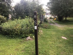
It was just a few miles until I reached the border with New York. I had enjoyed hiking in Connecticut. The AT here had its challenges, but I thought it was nicely balanced with miles of great trails, quaint towns, and interesting narrow views. Despite the sign, I think the trail meanders back into Connecticut for a few miles tomorrow before crossing back to New York for good.

Caesar Brook Campsite to Near Kent, CT, 12 mi (AT 721)

September 3rd, 2018, Connecticut

I walked the 3 miles to the village of Cornwall where I planned to stop by the Cornwall Market store and deli to get a bite to eat, charge electronics, and kill some time before heading toward Kent, just 12 miles further. I have a box coming to Kent but would not be able to pick it up until tomorrow, Tuesday, because of the Labor Day holiday.

The store opened at 8am and I was there waiting, already charging my stuff at the friendly hiker table with power strip on the front porch. I picked up a 12” Italian sub, an 8 ounce bag of salt and vinegar chips, and a pint of Ben & Jerry’s ice cream. Not your traditional breakfast foods but I had a feeling this was going to be the best breakfast ever. I ate half of the sub, some of the chips, and all of the ice cream. I have noticed that, while hiking, it is nearly impossible to gain weight. You can’t really carry or consume enough calories on most days. You can make up some of the deficit during town stops—then back on the trail you go.

When I was buying the food the cashier offered that the store has WiFi and gave me the password. So I sat at the porch seating, ate my “breakfast,” and watched the rest of the world come and go from the store. After a couple hours I finished the rest of the sandwich so I was charged up, both batteries and stomach, and ready to go. I just had to head maybe 8-9 miles further and find a place to camp, preferably at higher altitude. The weather today was going to be near 90 degrees and warm throughout the night. Higher up would be a bit cooler and, hopefully, breezy. The highest peak between here and Kent was not very tall, but every bit would help.

I went back in the store for a drink and another smaller sandwich to bring for later today. As I was coming out a man asked if I would like a ride back to the trail. I said I would love a ride and hurriedly packed up to go with him. He told me his daughter had completed her AT thru hike last year. He and his wife were in two cars and were getting ready to kayak on the Housatonic River next to town. They are from nearby and he gives hikers rides now whenever he can.

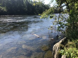
Once back on the trail I took my time hiking in the heat. There was a long, 5-mile walk along the Housatonic River. At an access point I took the opportunity to take a dip on the water to cool off.

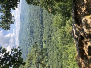
At the end of the river walk there was a very steep and rocky climb up to Caleb’s Peak at just over 1000 feet high.

I continued from there a couple more miles and made it almost to Kent before stopping around 4pm. It was early but there was no point in heading downhill to town. The post office wouldn’t be open until 8am.

Near Riga Shelter to Caesar Brook Campsite, 22 mi (AT 709)

September 2nd, 2018, Connecticut

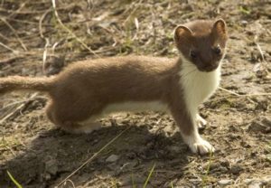
I awoke early, before daybreak, and started packing up. When I was almost finished I heard some rustling nearby and looked over with my headlamp. Small, shining emerald green eyes looked back but didn’t run away. A small animal went back and forth checking me out. What was I doing? Why was I doing it? The animal was about a foot long, but with short legs and thin like a ferret. It was very curious about me and although it “hid” in the bushes nearby I could easily see where it was because of its shining eyes. It ran back and forth and sometimes up on a log where I could see it better—and it could see me. This went on for a minute or two and when I moved to get my phone for a picture it finally ran off. But here is what it looked like. This is a picture of a short tailed weasel.

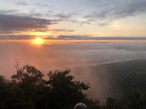
It was a beautiful sunrise and I stopped at an overlook for a minute. There was a section hiker camping right at this spot and enjoying the view. He said he was just out for the long weekend but had done about 400 miles of the AT so far.

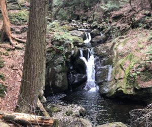
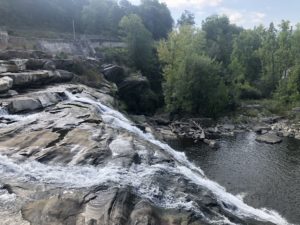
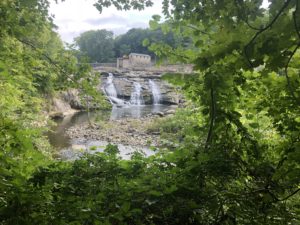
I had camped just 4 miles away from Falls Village which is a small town very near the trail. On the way into town I passed the falls.

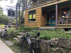
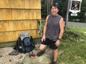
There is a small casual restaurant in town called The Toymaker Cafe. I took the short walk over to it and met another SOBO hiker, called Lake, also just arriving. The place was already crowded with bicyclists and motorcyclists our for the long weekend. We went in together, ordered at the counter, and hung out at the couch seating indoors while we ate. Lake said this was his 4th (!) time hiking the AT and would be his last long trail. He had also already hiked the Pacific Crest and Continental Divide Trails, so another triple crown hiker. He thought both of those trails were physically easier than the AT. He also hiked the Eastern Continental Trail which includes the AT as the middle section, connecting south Florida all the way to Newfoundland. This was his “last” long trail because he would be having a knee replacement in the next few years. But he said there are shorter trails that he still wants to do.

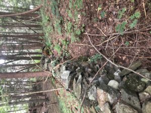
A few days ago, while talking with the caretaker at Upper Goose Pond, I learned something about the old stone walls deep in the forest here in New England. Apparently, when colonists arrived to America these areas were all that was available to them for farming. So, they cleared the land and used it for agriculture. They had to continually remove stones, with more surfacing each spring, and needed somewhere to put them. So the walls are primarily a place to put the rocks that needed to be moved and, secondly, were useful as boundaries and walls between properties. Later, once better farm lands began to open up to the west, these lands were given up and began to return back to forest land.

I finished my hike around 5:30pm at a tent campground just a few miles from the village of Cornwall Bridge. I will head into town tomorrow for a few hours. Then, the following day, I plan to make my way toward the next town, Kent, so that I can pick up my package from the post office and resupply.

Tom Leonard Shelter to Near Riga Shelter, 24 mi (AT 687)

September 1st, 2018, Massachusetts and Connecticut

I awoke to the strange sound of something, probably a porcupine, gnawing on the outside of the shelter. Apparently, chewing up wood is a thing with porcupines.

It was still dark but I was pretty sure I wasn’t going back to sleep again. With the light of my headlamp I packed up, ate breakfast, and got on the trail before 6am. I used the headlamp as supplemental light to see the trail better until the sun was fully up about 20 minutes later.

I followed the rocky ridge line for a few miles and it was nice to catch glimpses of the sun as it was rising. I was also enjoying the relative peaceful hiking without mosquitos. But the first ones started to appear before 8am. They continued to be a problem all morning, but I was glad for the towelettes I had received yesterday. The DEET really kept them from biting.

The ridge descended to meet the road toward Great Barrington. At the road I met three other SOBO hikers, called Steps, Bandit, and a third whose name I didn’t catch. They said they had completely run out of bug repellent on the trail. They were all wearing rain jackets to help but were beset with clouds of mosquitoes. I stood there, having recently applied bug repellent, and was fine, other than just having a few hovering around me. The three had just arrived to the road and were about to head into Great Barrington for more bug repellent. They were also a bit dirty and miserable looking, I thought. The touristy Great Barrington, in the middle of Labor Day weekend, was going to love this…

And Bandit was hiking barefoot, so he looked even more downtrodden than the other two. I have heard that some people hiked the AT barefoot, but had never seen one before. I had noticed over the past couple days occasional bare footprints in the mud. As I saw these I did wonder what the appeal was of forgoing any foot protection. But Bandit was young and everyone should be able to hike their own way. So I wished them luck and continued on.

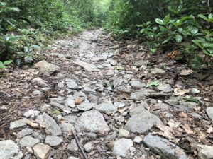
Later, I found myself walking on long sections of sharp, gravelly rocks and wondering how long it would take a barefoot hiker to walk the same path. Maybe he carries some type of shoes in his backpack?
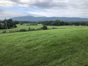
After passing a series of farm fields, the trail then crossed a long, low, boggy area between mountains. At the edge of one field there was a marker commemorating the last battle of Shay’s Rebellion.

And I passed a few oak trees that were perhaps the largest I have ever seen. You can just see my hiking poles leaning on the tree trunk.

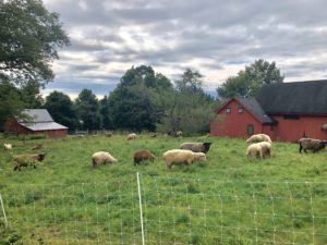
But a short while later I started climbing again toward the last few mountains of Massachusetts. On the way up I passed a group of sheep grazing in the grass. They were a little nervous to see me so close to the fence but let me get a picture.
As soon as I climbed a bit more the bugs almost disappeared, which after the past few days, seemed too good to be true. I met a NOBO hiker on the way and asked about the bugs up ahead. She said there hardly were any. I warned her about the upcoming sections—to get the bug repellent handy.

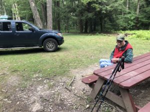
A short while later the trail crossed a parking area for a lake and picnic area. At the far end an older gentlemen was sitting at a picnic table and asked if I was thru hiking. When I said yes he asked if I’d like some trail magic. I told him I would love some. I asked his name and he said “Butterfly Bob.” He gave me a really good Clif Bar and some bottled water. I sat for a while and talked with him. He said he loved to hike but never had the chance to hike most of the AT. He was a Navy Seabee then left the service in the 70s. He worked as a carpenter and painter but is now retired. He didn’t even know what trail magic was until last year but comes out now about once a week to offer snacks to hikers. He was recently diagnosed with lung cancer and is in treatment, so can’t hike very far any more, though he still does some walking on trails every week. He said trail magic is his way of continuing to hike. “And,” he said with a smile, “nobody ever turns down trail magic.”
After leaving Butterfly Bob I crossed a couple mountain tops then descended to a gorge and river at the Massachusetts-Connecticut border.
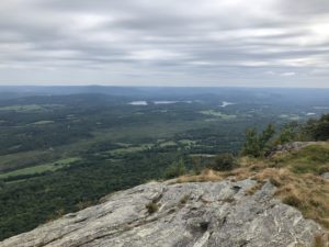
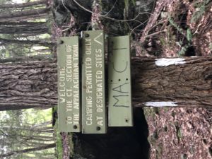
Then the trail went back up over two more steep climbs then down again before I reached Riga Shelter. Being a holiday weekend there were a lot of campers already there. I went a bit further beyond the site and found a hammock spot nearby. Connecticut, like Massachusetts, only allows camping at their designated sites. But given the shelter location was overloaded, I figured there weren’t many other choices this late in the day. And with a hammock, you don’t have to clear plants, sticks, rocks, etc from the ground so it is fairly low impact.

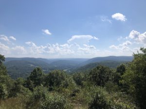
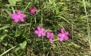
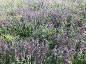
And here are a few other interesting things I passed on the trail today.

Upper Goose Pond Shelter to Tom Leonard Shelter, 21 mi (AT 663)

August 31st, 2018, Massachusetts

After packing up I went downstairs. A section hiker from near Boston stayed the night in his hammock outside. He was already downstairs as well. Two other hikers were still sleeping in the bunks upstairs. So it was just the four of us who stayed the night. Coffee was ready and the caretaker was about to make pancakes for the two of us in the dining area. She said we could have as much coffee as we liked but there was a three pancake limit per person. I still couldn’t believe there was coffee and pancakes for breakfast at an AT shelter—so three sounded heavenly to me.

I headed out from the cabin hoping to reach Tom Leonard Shelter just under 22 miles away. With the less elevation change and relatively nice trail surface in Massachusetts, I have been able to average between 2.0 and 2.5 trail miles per hour over the course of the day, including stops. 22 miles should take about 10 hours, or until about 5:30pm.

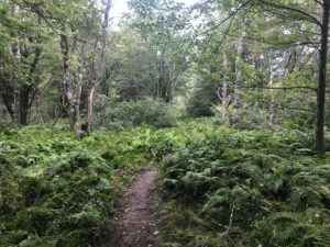
The trail was generally very nice and meandered through fern covered forests and more open, pine needle covered areas.

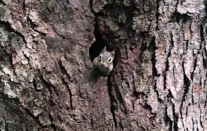
As I passed one big tree a very small, grey squirrel ran up and into a hole in the tree. He poked his head out and watched me intently. I’m guessing it was a baby squirrel, given the small size.

I passed again through fields, bogs, and even a farm field with cows in it. There was a step to let us cross over the barbed wire fence on each side.

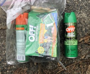
The past several days have been terribly buggy, with occasional swarms of aggressive mosquitos. Much of today was the same. There have hardly been any mosquitos until now, so I’ve only been carrying a small amount of bug repellent, which I’ve almost used up. I have been rationing it to last a couple more days until I reach towns again. But, at one road crossing, some “trail angel” left a bag with Deep Woods Off spray and individual towelettes. That made the rest of the day, and set up at camp, so much nicer. And I have three towelettes for later. Thank you!

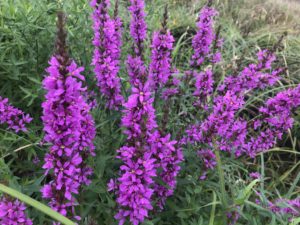
And here are a few other interesting things I passed on the trail today.

Kay Wood Shelter to Upper Goose Pond Shelter, 18 mi (AT 642)

August 30th, 2018, Massachusetts

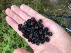
I woke up early and was able to get going by 6:30am. I had a quick breakfast and, when it was light enough, headed out. The temperature was perfect this morning-—much cooler than yesterday. Not long after I started I came upon a power line clearing with some nice blackberries. I picked a handful to eat and left the rest for other hikers and bears.

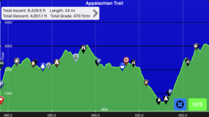
The trail was generally nice today—not too much climbing or mud. It was some of the more enjoyable hiking in a good while—just a relaxing walk in the woods. Here is the elevation profile of today’s hike. You will notice it is relatively flat, which is unusual.

Here is the one from yesterday’s hike—with a few more ups and downs.

In the early afternoon I saw something moving on the trail up ahead. It was small and, at first, I thought is might be a beaver or porcupine. As I got closer it rambled into the woods and I realized it was a young bear. It ran away faster as I got closer and I couldn’t get a picture or even a good look. But I kept moving in case mom was around. It was bigger than a small cub, so most likely it was a 2-year old out on his own a little bit.

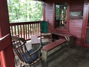
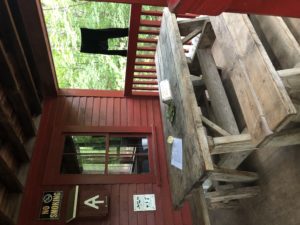
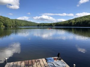
I made it to Upper Goose Pond Shelter around 2:30pm. I have had multiple NOBO hikers recommend a stay at this shelter. It is unique in that it’s a 2-story cabin with kitchen and dining area on the first floor and a bunk room for 14 upstairs. The bunks even have mattresses, which is a first. There is a nice pond with dock for swimming, canoes, and pancake breakfast in the morning. It is an AT shelter and operates with the help of donations.

The caretaker was out when I arrived and the cabin was locked. I went down to the lake for a swim and to rinse out my hiking clothes. It was a perfect day and seemed strange to be the only one here. Some kayakers paddled over to chat—two ladies from Albany, NY. They said it was about an hour drive and they come over here sometimes for kayaking. We talked about the trail and they wished me luck before continuing on their way around the lake.

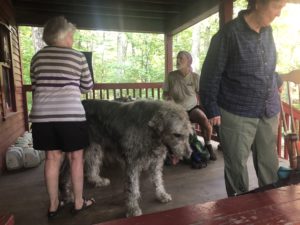
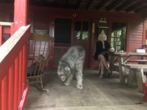
The caretaker returned around 5:30pm. She had two friends with her and her two dogs, enormous Irish Wolfhounds. We stayed on the porch and talked for a while. The two friends were from Washington state and the caretaker was local. She said she has been caretaking at the cabin for many years. The caretakers generally stay a week at a time before switching out.

Crystal Mountain Campsite to Kay Wood Shelter, 8 mi (AT 624)

August 29th, 2018, Massachusetts

There were about 15 Smith College students camping at the tent site last night. I had read in the trail app comments that the bear box lid was bent and mice could get in. There were some large rocks next to the box that had been used to help keep the lid down tight. I discussed this with the ladies at camp and put my stuff in the box.

The Smith students were preparing for orientation hiking trips that they were leading next week; each would have up to 7 new students on a backpacking trip. They were having a great time but quieted down around 9pm. Then it rained a bit overnight and there was a flurry of bright headlamp activity, tent setting up and adjusting, clothes gathering, etc. The next morning I asked how they fared in the rain and one said they ended up with five girls in their 3-person tent. It wasn’t supposed to rain and I think there were more people than spaces inside tents. Given that a 3-person tent is usually about right for two people, I’m sure they were crowded.

When I went to the bear box I found that mice had succeeded in getting into the box. They had nibbled a few bags, including mine. They didn’t get to my food but had made a 1 inch hole before giving up. I had to repair my bag with a patch. Again, so far, hanging my food has been reliable. But you are encouraged to use these bear boxes at the shelters and tent sites because the bears can’t get into them.

So, after the excitement of the morning I headed out for an almost 5-mile hike into Dalton. I decided to go to Walmart first—about 1.5 miles further, then spend the afternoon at the community center where they offered showers and a place to charge my phone and power bank. Also, with 90 degree weather expected, I thought it best to be hanging out indoors rather than walking back and forth to Walmart.

The community center had nice showers and provided shampoo/soap and a towel. They allowed hikers to use the facility for a donation. After getting cleaned up I went across the street to the local burrito place while waiting on my power bank to charge. It can take up to 6 hours to go from empty to full so I wasn’t likely to get a full charge. This is one down side of minimizing “zero” days. I’m going to have to figure out how to manage that—or start spending more time in town.

After a mind numbing wait, I was charged to over 3/4 full and it was about time to go. I had already read several 1980s National Geographic Magazines cover to cover. I must say, those do stand the test of time—still just as fascinating as when they were new.

So, it was time to go and I wanted to eat something else for dinner before making the 4 mile walk out of town and to the next shelter. On the way I stopped at Angelina’s Subs and ordered some food. They offered WiFi—which reminded me that I hadn’t had time to upload entries and photos to this blog. That also takes a good amount of time in town—wherever I can get power and WiFi. So I hung out at Angelina’s for a couple more hours and got caught up. Luckily they weren’t too busy and didn’t mind.

Finally, I headed out of town—on a full stomach and with five more days of food in my pack. The day was still hot and I was glad it was just another few miles to the shelter.

When I arrived there were just two others there. They had a fire going and I stopped to say hello. Both men were French, on from near Paris and the other from western France. This was their second day hiking and they were on a 35-day trip. They had hoped to reach Mt. Katahdin but, at this point, realized that they might not make it that far. They said they were used to hiking in Europe where you don’t need to carry a tent and much food. You can stay at the hiking huts with bunks, dinner, and breakfast, and have a very light load to carry during the day. They said this type of hike required more logistics planning. But they seemed happy to be here and were looking forward to their trip.

South of Williamstown, MA to Crystal Mountain Campsite, 18 mi (AT 616)

August 28th, 2018, Massachusetts

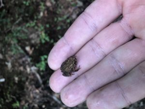
On my way today I saw hundreds of tiny toads—one at a time here and there. I started seeing them a day or two ago but they are in full force now. When you get close to them they start hopping madly to get away so avoiding them was part of the hike today.

I camped just outside of town on the way up Greylock Mountain. Greylock is the tallest peak in Massachusetts and is apparently popular with visitors and hikers. Being a Tuesday and with very warm weather expected, I didn’t see many people on the way up.

The top was built up with a 1930s era war memorial and observation tower, parking areas, and a lodge with small cafe. I stopped at the lodge for water and to eat lunch at the picnic tables nearby. The young lady at the cafe register told me she had already hiked most of the trails around here and was thinking about hiking a long trail next year: either the Pacific Crest or the Continental Divide Trail.

On my way down from the mountain I ran into a few more hikers, including a few NOBOs who seem to be getting more infrequent. I think, with Baxter State Park closing around mid October, it’s only a handful of late northbound hikers remaining south of me.

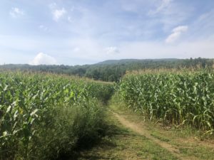
The trail passed a number of narrow views and lovely meadows and farm fields. For the first time the trail passed through an active field—with corn growing.

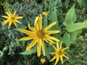
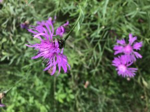
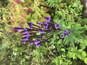
And here are a few more nice wildflowers I saw on trail today.

South of Porcupine Lookout to South of Williamstown, MA, 22 mi (AT 598)

August 27th, 2018, Vermont and Massachusetts

My goal today was to get near the towns of North Adams/Williamstown for resupply. I had carried five days of food from Rutland and today was day five. I had just enough food for today and a few snacks for the morning, if needed.

The trail went up to a few nameless peaks and down to a few roads and rivers on my way. As I was climbing down to a good sized brook for water, it occurred to me that, since Maine, all the stream and river crossings have either been simple rock hops or various types of bridges. There have been no more actual river crossings. In Maine, the river below would have been crossed on foot.

Everywhere else so far has bridges—perhaps because these states are closer to populated areas and are more heavily used.

And the trail in southern Vermont continued the muddy pattern of the past two days, only a little more intermittent now. This area must be perfect conditions for mud and beavers, because they have plenty of both. In one area the beavers had created what looked like an infinity pool—very stylish.

Late in the day I crossed the border with Massachusetts. On one side was information marking the start of the Long Trail into Vermont.

On the other side was the marker for Massachusetts. I passed a number of NOBO hikers who were excited to be hitting Vermont, their 12th state. It is number four for me.

You would think crossing state lines would be fairly transparent—with no real changes in scenery. But somehow there was a rather quick shift to different type of rock and some new plants that I hadn’t seen in Vermont:

There was this bendy sort of pine tree. I think this is the same pine I’ve seen, but smaller and contorted because it’s on a mountain top.

And a three-lobed leaf; maybe sassafras?

And what may be a mountain laurel?

All of these showed up within a mile or two of crossing the border.

Just a few miles further I came to North Adams where the trail passed through town.

I walked to the grocery and picked up a few things to hold me over to my next planned stop in Dalton, Massachusetts. Dalton, just over a day’s hike, has a Walmart and community center with showers so I plan to spend at least a half day there.

Also, for the first time I can remember, I had phone service walking around town so I was able to call home and chat while I walked. I headed out of town and back to the trail. It was getting late and the sun was almost down. Once in the woods, it gets even darker. So I stopped just outside of town at the first place that seemed suitable.

The day had been hot and the evening was still warm. I put on my headlamp and started to set up camp. I didn’t feel like putting on bug repellent right before bed so I just battled mosquitoes as I worked—but when your hands are busy the mosquitoes win. Mosquitoes haven’t been a problem until very recently but there seem to be a lot more from southern Vermont to Massachusetts.

Then several times during the night fast moving trains came through town. I was quite far from the tracks but the slope of the land seemed to send the sound straight up to me. And they had no problem blaring the horns as they passed through town.

And in between trains I listened to a pair of owls dueling for hooting champion of the week. The night reminded me of the movie My Cousin Vinnie. If you’ve seen it, you may remember what I mean. If you haven’t seen it, you should.

And, sleep issues aside, here are a few of the beautiful things I noticed along the trail today.

South of Stratton Pond Shelter to South of Porcupine Lookout, 26 mi (AT 576)

August 26th, 2018, Vermont

For several days now I have been hiking on the co-located Long Trail and Appalachian Trail. The Long Trail is the first trail of its kind and, at over 270 miles, links Vermont’s southern border with Canada to the north. The Long Trail was the inspiration for the Appalachian Trail which came a couple decades later.

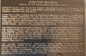
Today the trail headed over Stratton Mountain and Glastonbury Mountain. Stratton Mountain is notable as the “cradle of the Long Trail and Appalachian Trail” and it was reportedly at this site both ideas were formed.

There was an observation tower up top with great views.

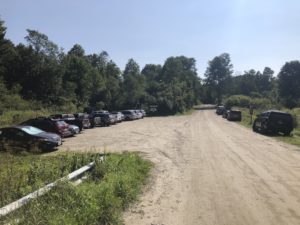
On the way down the mountain there were dozens of day hikers coming up. At the bottom of the mountain I found where they were all coming from.

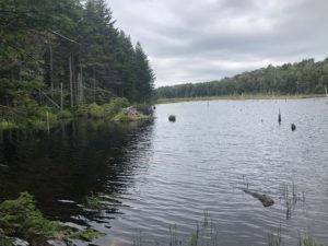
Then I passed another beaver pond. This time I could see the beaver’s lodge not far from the trail.

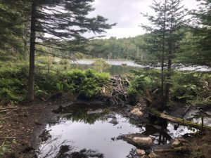
And on the other side I marveled at the effectiveness of the dam. It may be hard to see in the photo but the water level of the pond is about three feet higher than where I’m standing below the dam. The pond is completely held back by the beaver’s work.

Glastonbury Mountain came later in the day and was uneventful. There was another observation tower but I didn’t go up. The sky had become overcast and there was a 40% chance of rain in the afternoon. I continued on from there for a few more hours. As I was getting water near a shelter I met a hiking trio called Jackrabbit, Sunrise, and Two Socks. They were finishing the AT which they started last year. Jackrabbit has gotten injured so they couldn’t finish until this year.

And I made it quite far today. I only have one more day of food so I wanted to be in range of North Adams for resupply tomorrow evening or the next morning. So it was getting dark when I arrived at my stopping point. I hurried through setting up camp and making dinner and settled down right away—exhausted from the day’s hike.