Base of North Kinsman Mountain to Beaver Brook Shelter, 14 mi (AT 391)

August 15th, 2018, New Hampshire

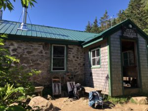
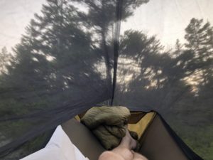
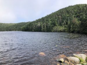
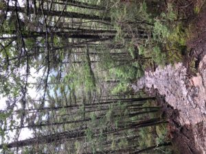
The stream near my camp was running slowly and was tinted brown. It would have been fine in a pinch but I hoped to find better water at the next opportunity. After packing up I made my way about a mile uphill to Kinsman Pond Shelter. The water source for the shelter was an alpine pond. It was better water and after filtering I drank some and took some to go.

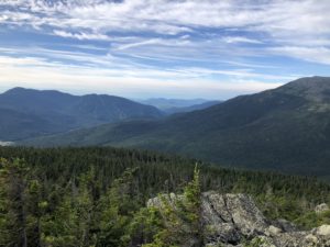
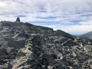
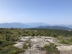
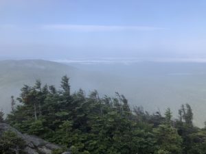
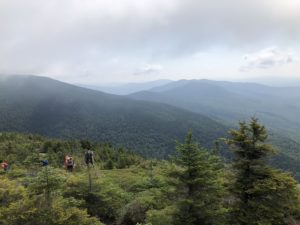
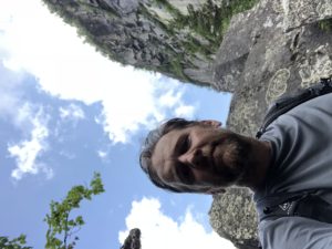
The weather was unsettled and shifted from sunny to overcast, then back again. The trail crossed he two Kinsman peaks, both over 4000 feet then eventually down to Mt Wolf at 3500 feet. After I cross Mt Moosilauke tomorrow, the trail generally stays below 4000 feet until Virginia—-many miles from here.

I learned that there are something like 48 peaks in New England higher than 4000 feet. It is a popular goal around here to summit all of them. We saw some of this in the Presidential Range near Mt Washington (with the cog railway, auto road, and cafeteria up top). There are other popular loops or “traverses” that people try and do in a single day as well. So I have come across many different types of hikers and trail runners over the past week. It has been quite different from the quiet hiking in Maine.

The 48 peak challenge reminds me of another hiker I came across in Maine some weeks ago. I was coming downhill and a hiker was coming up. Except this hiker didn’t look like anyone I had seen on the trail before. He was very heavy, maybe 400 pounds, and huffing and puffing his way up hill. He didn’t see me and I tried to make some noise as we approached each other. He was focused on the trail and working hard so he still didn’t notice me even though we were just 10 feet apart—so I greeted him with “hi, how are you?” He jumped and screamed a blood curdling scream and I was briefly scared he would fall down the mountain. I said, apologetically, that I didn’t mean to startle him and asked where he was headed. He put his hands up and said, almost embarrassed, “I’m just a peak bagger!” I wasn’t sure what that meant at the time but have now seen what a popular activity it is around here.

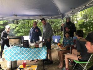
I also enjoyed another small round of “trail magic” toward the end of the day. I crossed a road in the valley just before my last couple miles. In the trail parking area there was a car set up making sandwiches for thru hikers. Early Bird had completed the AT this year in July after starting in April—in something around 90 days. Most people complete the trail in 4 to 6 months, so she was very fast. In fact, one NOBO who happened to stop by while I was there started in April with her and they remembered each other. He was still heading north and had another month to go. She has now completed all three long trails in the United States, the other two being the Pacific Crest Trail and the Continental Divide Trail. Someone who has successfully completed all three has accomplished what is called the “triple crown.” And here she was a month after completing the AT spending her day providing “trail magic” to other hikers. There were about 8 of us who walked up together and she made us breakfast sandwiches using her tiny hiker stove.

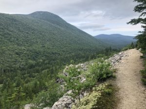
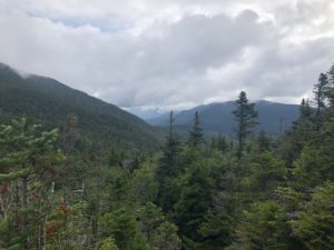
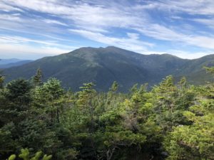
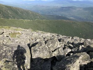
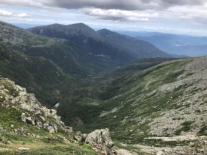
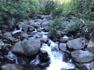
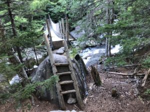
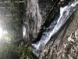
After the trail magic I continued by another series of waterfalls and cascades. The final one, Beaver Brook Falls, continued on and on for more than a mile. You could only see a few hundred yards up stream at a time. But each time I would crest a hill the falls rose above me yet again. The trail followed the falls very closely. The views were constant and amazing.
Base of Mt. Garfield to Base of North Kinsman Mountain, 15 mi (AT 377)

August 14th, 2018, New Hampshire

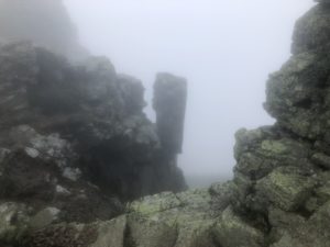
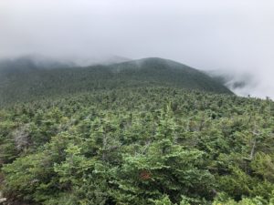
It was another misty and rainy morning. I was glad it was cool because the hike went immediately up the 4500 foot Mt Garfield. After climbing and descending, the trail then climbed Mt Lafayette at 5200 feet then short down and ups above tree line over a few more peaks. Visibility was very poor and once I was up top it started raining. Luckily there had been no thunder all morning as I walked for maybe 3 miles on the exposed ridge.
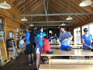
Then I began the long descent toward he valley below. The map showed the trail intersecting with Interstate 93 and I could hear the traffic for a good part of the hike down. I passed a number of NOBOs, day hikers, and other backpackers as I went down.

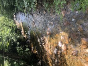
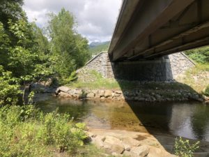
Around mid day the sun finally broke through and the rain stopped. At the bottom of the valley the trail crossed a fast moving river and then went under the highway.

There was only one AMC hut remaining on my way—Lonesome Lake Hut. At this point I was undecided whether to try and get a “work for stay” at the hut, which includes a meal, or hurry my way up and hope they had soup and baked goods left when I arrived. So I just hiked along as quickly as I could and would decide after getting there.

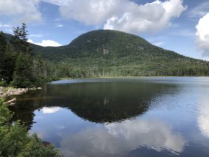
The hut was located on beautiful Lonesome Lake.

I arrived to the hut about 3:15pm and saw they still had a few heavy duty brownies for sale plus some kind of hard rolls. They also had a potato, broccoli, and cheddar soup as well. So I decided to make good with what was available and skip asking for a work for stay. With this extra food I expected I could reach Glencliff, New Hampshire within two days without food resupply. Although the town of Lincoln was a full day closer, it happens that I already had a box waiting for me in Glencliff. If I stopped in Lincoln for food, I would still need to stop in Glencliff for the box—and I wanted to avoid stopping twice in two days, if possible.

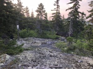
I went about a mile further up from the hut and found a place to camp near a stream. I was now 22 miles from Glencliff with a couple steep mountains in between. And once I reach town, my time in the White Mountains National Forest will be finished. At that point the mountains get smaller and it will only be another 40 miles to Vermont.

Near Ethan Pond Shelter to Base of Mt. Garfield, 13 mi (AT 362)

August 13th, 2018, New Hampshire

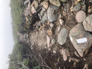
It was a nice, smooth trail for a number of miles this morning and I had a hard time remembering the last time we enjoyed a trail like this. It’s been a while.

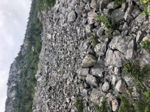
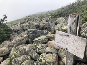
It even passed a giant rock slide that we didn’t have to traverse at all. That made the trail even more enjoyable.

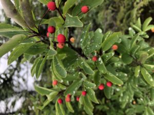
In addition to blueberries there is another fruiting shrub up high in sunny places. The bark and leaves look similar to blueberries but the fruit is red as it ripens. I am wondering if it is a serviceberry plant but am holding off trying the fruit until I find out for sure.

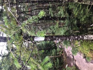
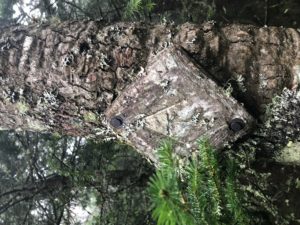
I also notice that New Hampshire marks some tiny trees with white blazes. Before now the markings were always on mature trees. The markings work just as well and I’m guessing the trees will just grow into them.

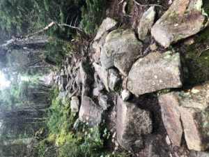
The hike took me over Zealand Mountain, Mt Guyot, and South Twin Mountain which were a series of ever higher peaks which didn’t have too much downhill between them. They just sort of worked their way higher throughout the day before dropping me back down a bit lower to the place I stopped for the night. There was a good bit of rocky up and down. The rocks were still wet from yesterday but dried slowly as the day went on.

I succeeded in getting eggs, oatmeal, and sausage from Zealand Falls Hut around 9:15 today. That allowed me to save some of my food for tomorrow.

I also stopped at Galehead Hut around 2pm for a bowl of soup. I hoped they had baked goods for sale but were all out except for two small muffins which I bought to eat with the potato leek soup.

I pushed on from the hut for just a couple more hours. I found a nice site, cooked dinner, and camped for the night. I also did a rough inventory of my remaining food. I had about six thousand calories remaining. This would suffice in normal life for three days but for maybe 1.5 days of hiking. I hope to hit the next hut, which may also be my last one, early enough to pick up some extra baked goods to augment my food tomorrow. I should be able to make a resupply run soon. I can get off trail either 27 or 37 miles ahead. Given my pace here in the Whites, 27 miles over two days is probably easily achievable but 37 would be a stretch.
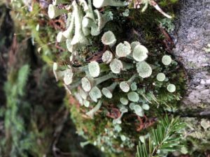
And here are a couple of the other interesting things I noticed on the trail today.

Nauman Tent Site to Near Ethan Pond Shelter, 10 mi (AT 349)

August 12th, 2018, New Hampshire

It rained overnight and was still raining when we awoke. I didn’t get started until about 8am, slow partly from yesterday’s long hike and partly from today’s rain.

Then I noticed what must be the oldest trail marker I have seen. It is the old “AT” symbol and not a white blaze.

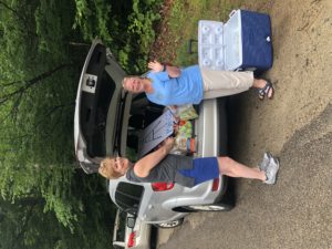
I hiked for about four hours and reached a main road where the trail crossed. There were a couple possible places to resupply food on this road, but several miles away. I was just thinking that I probably still had enough food but would need to time my hike tomorrow to get some soup for lunch from the next hut. As I approached the road two ladies were standing looking at the trail sign. They asked me if I knew where the AT went from here. They were clearly not hikers but I figured they were meeting someone. I showed them where it was and they told me they were setting up some “trail magic” and to come over. This was the first time I had come across trail magic and asked to take their picture. They had fresh fruit, sodas, snacks, and some other things hikers might want or need. I stayed with them for a little while—happy to finally have experienced the magic. Thank you, ladies!

Then, because when it rains it pours, there was more trail magic set up about 1/4 mile up the road, at the end of the parking area and just before entering the forest again.

After both rounds of trail magic I realized that I wouldn’t get quite as far today as I intended. But I was full and ready for the next section—a slow walk uphill from the road. I hiked a couple more hours and found a quiet place to “stealth camp” as it’s called. It’s usually a misnomer, as most of the “stealth” sites are literally right next to the trail—not very stealthy. Usually it just means an “unofficial” campsite. But I went a good ways off trail tonight because the ground was flat enough and the trees were not too dense in this little patch of forest.

Osgood Tent Site to Nauman Tent Site, 15 mi (AT 339)

August 11th, 2018, New Hampshire

I started my hike one month ago—July 11th. The time has flown and it’s hard to believe a month has passed. Poet (from Shaw’s in Monson) advised us to take our time in Maine and New Hampshire and make up time later in the hike. I thought it was good advice at the time and, based on my pace, seem to be following it.

Unfortunately, I didn’t see any of the meteors last night: too many trees and too tired!

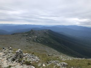
I started from the Osgood Tent Site at the base of Mt Madison and I got on the trail before 7am. It wasn’t long before I was above tree line. Almost the whole day was above tree line which is unusual. It also made for spectacular views.

We were fortunate today with the weather. It was clear with light winds until some high clouds moved overhead mid afternoon.

The climb up Mt. Madison reminded me a little of my first day—climbing Mt. Katahdin. It was basically a steady climb up a giant rock slide.

Just on the far side of the mountain was Madison Spring Hut. I arrived at 9:20 and they had scrambled eggs and oatmeal left over. The eggs were great but the oatmeal didn’t have any salt or sweetener. Despite this it still tasted good—just as raw calories I think.

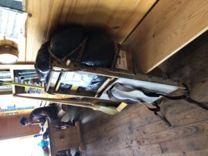
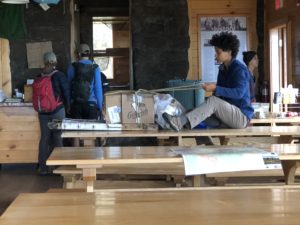
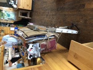
While I ate I watched one of the workers packing up boxes and trash to be carried out. She strapped everything to a crude wooden frame with leather shoulder straps—which is how things are brought up and down. There were two more of these packs already lined up and ready to be carried down.

I continued on from the hut toward Mt Washington, the second highest peak east of the Mississippi. The highest peak is Clingman’s Dome in North Carolina and is also on the Appalachian Trail. However, given the climate and geography, Mt. Washington is apparently famous for having, reportedly, the “world’s worst weather.” I was happy to have a good weather day.

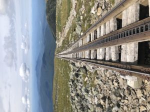
It was a Saturday and Mt. Washington is a popular destination for visitors and day hikers. There is an auto road all the way to the top as well as a cog railway to bring visitors up and down. As I approached Mt. Washington for what seemed like hours, I watched cars heading up the road and heard the cog railroad going up and down.

I reached the summit around 1:30pm and worked my way through the crowds to the cafeteria. You had a choice between pizza, chili, and hot dogs. I went with pizza and chili. It wasn’t anything to write home about but was filling and welcome.

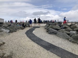
Outside, there was a long line of people waiting to take a picture next to the summit sign. I didn’t wait and decided to just take a picture of the people.

On the way down from the summit I passed Lake of the Clouds Hut but didn’t stop in. It was only 2pm and I wanted to get a bit further before stopping.
I continued for almost five more miles to Mizpah Hut and Nauman Tentsite. I would have stopped sooner but didn’t come across anywhere suitable to camp. On the way in I passed Thor, who was already set up in his tent. I was surprised that I had caught up with him because he hikes faster than me. I guess he just hiked for a shorter period and has longer to rest in camp. I came in with a hiker called Chaco who was heading northbound. We stopped at the caretaker’s tent to register. Many of the official camp sites in the Whites require a small fee per person. The caretaker assigned us an area to set up our hammocks near two other NOBOs already there. We exchanged some details about upcoming sections while getting set up. There was a raucous group staying at the hut nearby. They were having a great time but thankfully they settled down shortly after dark.

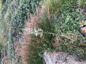
And here are some other interesting things I passed by on my hike today.

Near South Carter Mountain to Osgood Tent Site, 14 mi (AT 324)

August 10th, 2018, New Hampshire

We had camped about 4 miles from the first Appalachian Mountain Club facility called Carter Notch Hut. We all ate a bit before we left camp and headed out before 7am.

Flower Power and I arrived at the hut at 9:15. It was located in a beautiful spot on a lake.

We dropped our packs, went in, and inquired about leftovers from breakfast.

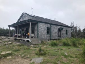
They had pancakes and oatmeal. The others arrived a few minutes later and joined us. The guy working the kitchen said the hut had a staff of 5 and it was his day to cook. He had served breakfast for 40 guests and was already preparing for dinner. Everything at the hut is carried in and all the trash is carried out on the trail by the staff. We were thankful for the breakfast and short rest. The “hut” was a quaint and rustic building and was an amazing sight nestled alongside a mountain lake.

After our “second breakfast” we headed on toward Wildcat Ridge. We continued along the ridge for several hours and stopped for lunch at an observation platform at the top of Wildcat Ski Area. Being a Saturday, the gondola was operating and bringing visitors and day hikers up from the valley below.

After the break I headed out—ahead of the others. I wanted to make sure I made it down to Pinkham Notch Visitor Center. My plan to only carry 4 days of food for an 8 day hike depended on hitting certain food stops in time—and the visitors’ center cafeteria closed at 4pm.

On the way down I met a couple, Scottish lady and English man, thru hiking NOBO. We discussed what to expect in each direction. They had climbed Mt Washington the day prior with rain and high winds on the trail. I said I planned to hit that point tomorrow and, last I saw, the weather looked okay.

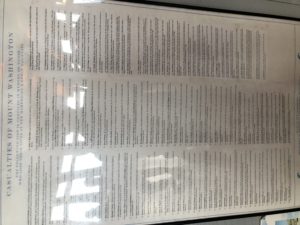
The lady said the hike on Mt Washington was harrowing with gusting winds yesterday. And I assume Scots know something about wind, rocks, and rain and was inclined to believe them. Mt Washington is known for dangerous conditions in bad weather. We are all hoping for a good weather day.

I made it down to Pinkham Notch Visitor’s Center by 3pm. On the advice of a NOBO hiker sitting outside I ordered The Washington (sandwich with beef, horseradish, cheddar cheese, and onion) and a salad. I think it was excellent—but most fresh foods taste really good after a hike, so I can’t be objectively sure. And, as I write this in my hammock at night, it is making me hungry again just describing it…which I think is a bout of what they call “hiker hunger.”

After the second lunch I continued about four miles further to Osgood Camp Site. This is the closest campsite to Mt Madison and Mt Washington, my objectives for tomorrow.

The camp was quite full, I’m guessing because of the weekend. I’ve read that the trails in the Whites are some of the most popular and crowded trails in the New England during the summer. We have seen quite a lot of day hikers up and down the trails over the past two days. And I think the AMC hut system makes it easier for them to access the more remote areas of the National Forest.

Also, tonight is supposed to be an excellent chance to view the Perseid meteor showers. The skies look clear and I hope to see something if it. However, the Appalachian Trail is informally known as the “green tunnel” because of the dense tree cover. I only have a limited view of the night sky but will be looking anyway…

Rattle River Hostel to Near South Carter Mountain, 12 mi (AT 310)

August 9th, 2018, New Hampshire

The trail from the Rattle River Hostel was a road walk for a quarter mile before it turned and headed back into the woods. There was a parking area at the trailhead and a lady was set up there doing “trail magic” offering hot coffee to hikers. Trail magic is some sort of unexpected gift to passing thru hikers—usually food. I have heard a lot about trail magic from northbound and flip flop hikers and I think it’s more common for the NOBOs. So I haven’t mentioned trail magic because I haven’t come across it yet. Until today. And, just my luck, having just left the hostel I was too full to even accept the coffee.

The trail followed the Rattle River up the side of Mt. Moriah. The river was very rocky, with large tan, brown, and reddish granite stones. I noticed quite a few nice pools which would have been good for cooling off had the weather been warm. But it was cool and cloudy and by mid morning it started to rain.

It rained gently for less than two hours before the sun started to break through again. It stayed very windy and unsettled for the rest of the hike but it never did rain again. I reached the top of the first mountain then down the other side for a bit. I detoured over to “Imp Campsite” to check it out and get water. I have no idea about the name but there is an Imp Trail nearby as well. The shelters here have a different look from those in Maine. This one was two levels, sort of like a loft for sleeping above and below. It also had a bear box, the first I had seen on the trail.

After my break I returned to the trail and continued up toward the Carter Mountains. I reached a nice vantage point and stopped for a look now that the clouds were lifting. As I was standing admiring the view of the valley below, two hikers came from the opposite direction and joined me. Galaxy and Songbird were a married couple doing a flip flop hike from Harpers Ferry north. After completing the northern half they planned to leave the trail for a few weeks to visit friends near Washington, DC then continue south to Georgia. Given their timing I offered that we might see each other again somewhere down the trail. They seemed happy and friendly and I hoped to run into them again down the way. Before we parted we saw a single orange butterfly flying furiously above us and toward the mountain like it was his job to get through the wind, over a 4000 foot mountain and down the other side. We all looked at each other and just laughed.
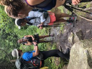
I passed the two retired Navy hikers, Lucky Boy and Cheesesteak, who were slackpacking the section northbound. I always find it funny to pass other SOBOs who are heading in the “wrong” direction. At this point I have preferred to take the trail as it comes—in one direction only. But lots of hikers like to slackpack so it seems pretty common.

My goal was to get about 11 miles in and find a place to camp for the night. Before 4pm I found a nice spot in the “saddle” between two mountains that had been used as a camp site before. A little while later Yogi Bear, also doing this section northbound, stopped by. He mentioned he would finish the section tomorrow and be off trail for a few days visiting a friend who lives in New Hampshire. I told him my plans for the next week or so and he said he’d text when he got back on trail.

A little while later the Quick Fix, FlowerPower, and Little Red showed up looking for tent sites. Like me, they had reached the shelter early in the day and decided to push on. There was just enough room for their two tents. I asked how Maine-iac had fared with her injuries. She made it with them to Gorham and arranged to return to the Hostel of Maine to work for a few weeks and rest. She wasn’t ready to go home and give up on her thru hike attempt this year.

We discussed how to time our departure tomorrow in order to arrive at the first AMC hut in time for breakfast leftovers. The huts cook breakfast for their guests and offer any leftovers to hikers. We decided to leave before 7am in order to be there before 9:30.

We were camped above 4000 feet so it was cooler than in the valley below. The wind continued through the night which made it feel even colder.

Near Mt. Hayes to Rattle River Hostel, 3 mi (AT 298)

August 7th, 2018, New Hampshire

Throughout the evening last night there were huge thunderstorms to the north. From my vantage point up high on the mountain I could see the lightning flashes and rolling black clouds pounding the mountains maybe 15 miles away. The sky above me was clear as a bell but at the moment I was wishing I had camped a bit lower down the mountain. Fortunately the storm stayed to the north but the thunder continued to echo for hours.

I was up early and happy to be dry. There was a beautiful sunrise and no sign of last night’s storm. After a short walk downhill I crossed a bridge over a large river and next to an old hydro power station. At the edge of the station property there was an apple tree along the fence with a few ripe apples hanging down. I have seen crabapples growing wild but this one was different. It was tart, maybe too tart, but the price was right and I ate most of it.

After a few minutes more I reached the edge of Gorham where the Rattle River Hostel, literally right on the trail.

Thor arrived a little while later. We got checked in, did laundry, took the shuttle to Walmart for resupply, and stopped at Mr. Pizza for lunch.

The Whites apparently have a series of “huts”run by the Appalachian Mountain Club that have bunks and include breakfast and dinner. They are large facilities that house between 30-90 people. Most of them are not accessible by road so everything is hiked in.

The bunks are by reservation only and generally used by those hiking for a few days in the park. However, of interest to Appalachian Trail hikers, they do have baked goods, snacks, and warm soup for sale during the day. They also offer thru hikers “work for stay” which gives you food and an inside stay (with your own sleeping pad and bag) in exchange for a bit of work after dinner or breakfast.

It seems like it will take perhaps 8 days to hike through the Whites and I was glad to learn there is some food available along the way. I need about 2 pounds of food per day. I can probably get by carrying 1 pound per day if other sources are available. That saves a lot of weight. With the ruggedness and difficulty of the Whites, fewer pounds carried sounds like a good thing. Despite that, my food bag still seems to weigh like 10 pounds—I may have bought too much…but I will try to eat a lot in the early days of the hike.
After my resupply and rest I will get back on the trail and into the Whites.

Near the Maine-New Hampshire Border to Near Mt. Hayes, 13 mi (AT 295)

August 6th, 2018, New Hampshire

After the long day yesterday I got back on the trail a little later than usual—around 8am. I was camped so close to the New Hampshire border I crossed it just a few minutes later, which was a nice milestone: my first state complete!

The first landmark in NH is Mt. Success and it was a steady climb up to the top. Thor caught up to me on the way up. We chatted for a minute and he continued on at his faster pace.

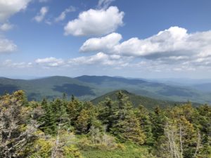
Up top, the great weather continued. The views were a bit hazy but spectacular. I used my Guthook app (trail map application) to orient myself. I could see the White Mountain National Forest (the Whites) rising higher in the distance to the southwest.

After a short break on top of Mt Success it was time to move on toward Gorham, the next trail town about 15 miles from me. I would arrive late in the day so it would probably be a waste to sleep in town. I planned to look for a camping spot somewhere close to take a “nero” (near zero mile day) tomorrow.

Later I came across some areas where trail crews had been working. They had marked some trees with orange ribbon, sometimes with writing like “stairs all the way down,” etc. Much of the work was in progress, although no one was working at the moment. There were many rocks partially excavated, like they were digging to see what shape and how large they were. Then they would use some sort of leverage to move them around toward the trail and into place. The rock in the picture below was about three feet across and must have weighed hundreds of pounds.

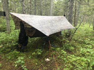
Once I got within a few miles of town I started looking for a place to camp. It had been a warm day in the high 80s and seemed like it would be a warm night as well. So I settled on a hilltop location near Mt. Hayes, the last climb before Gorham. Tomorrow I would just have to head downhill for a few miles. It was the first time I have camped up high in an exposed location and I hoped the wind wouldn’t be a problem. After dinner I hung up my food bag and got in the hammock and watched the sun set for the first time on my hike. Usually I’m well into the trees and can’t see the sunrise or sunset.

And here are a couple of the other interesting things I came across today.

Near Eyebrow Trail to Near the Maine-New Hampshire Border, 14 mi (AT 282)

August 5th, 2018, Maine

It was a foggy morning but I could tell the sun was trying to work it’s way through. I got back on the trail around 7am and continued the climb up Old Speck Mountain. I made it up but was in the fog and there was little to see. On the way down the other side I passed by a nice lake then met an older couple, Detour and Tag Along, who were finishing 20 years of section hiking on the AT. They would complete the whole trail at the main road later today. I congratulated them and continued on.

I reached the top of Mahoosuc Arm around 10:30 and started down. I came up behind two older hikers called Lucky Boy and Cheesesteak. Lucky Boy lives in Falls Church, VA and Cheesesteak is in Charleston. They are both retired Navy and are heading to Harpers Ferry to complete their flip-flop hike.

I reached the bottom of Mahoosuc Arm without incident and stopped at a stream for water and lunch. I was only a short way from the start of Mahoosuc Notch.

As I was heading out from lunch I walked with a young hiker from Green Bay, WI called Thor. He had longish blond hair and looked a little like the actor from the movie. We started the Notch together. It was not so much hiking as climbing over and under giant boulders.

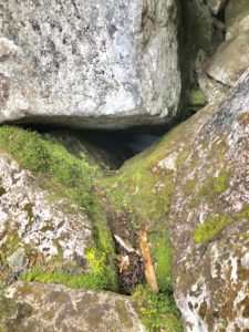
The interesting thing was, as the warm summer wind blew, very cold air would come up from the crevices and caves below us. I guess it was about 40-degree air and it felt like someone left a giant freezer door open. You could even see wisps of fog rising up where the more humid air met the cold air. This continued the whole time and at one point I got a glimpse of some ice down below some of the rocks. It was hard to believe ice was present in August but there it was—and you could feel the cooling effect throughout the Notch. In the picture below, you may be able to see a white patch of ice inside the dark triangular cave. The cave was about four or five feet across.

About half way through Thor got ahead of me and I didn’t see him again today.

Once I finished I came upon four hikers who had also just finished. I knew three of them, including the couple from Minnesota and Little Red Riding Hood, from several weeks ago at Shaw’s in Monson, then we crossed paths again a few days ago at the Human Nature Hostel. There was a girl with them I hadn’t met called Maine-iac. It turns out they were all hiking together today and she had slipped and fallen down in a crevice about 15 feet or so. She had some scrapes and bruises but, more seriously, had hit her head on the rock.

She was coherent and wanted to keep hiking. So we continued as a group up toward the next mountain. I suggested when we reached the top we try and call for some medical advice in case she had a concussion. When we got up there one of the group called a hiker buddy, Defib, who just retired after 30 years as a paramedic. He advised to watch for nausea, lethargy, and to wake her up every two hours to make sure she was still coherent. We continued on to Full Goose Lean-to where they planned to stop. They planned to take turns checking on her through the night. With all seeming under control, I said my goodbyes and continued on.

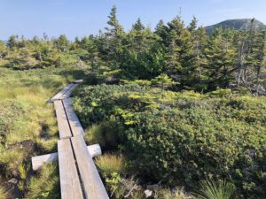
I hiked for several more miles, nearly to the Maine-New Hampshire Border. The weather was clear all evening and it was a nice hike. Between several mountains there were alpine bogs with the log bridges to help cross them. I had been warned that several of the bridges were just floating. If you stepped on them they immediately sunk down and you would be waist deep in the bog. I was careful to test out any questionable ones and found several that sunk deeply when I checked them.

It was already twilight when I set up my hammock. I had to cook dinner while using my head lamp. I would have stopped sooner tonight but couldn’t find a suitable spot to set up for quite a while.